LFA-7 "Mach Loop", Wales
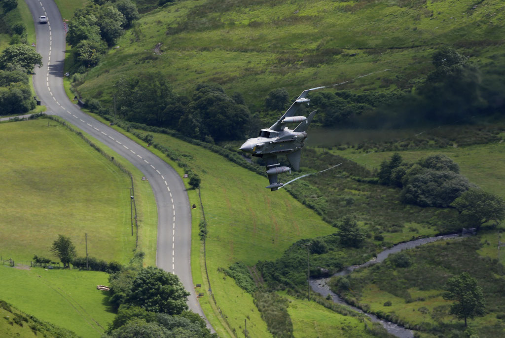
The Mach Loop is a set of valleys, situated between Dolgellau in the north, and Machynlleth in the south (and from which the Mach Loop gets its name). The area is regularly used for low level flight training, with flying as low as approx. 250 feet (equals around 76 meters), from the nearest terrain.
To the south of the Mach Loop there is an area called Tactical Training Area 7T, in which, at specified times, the aircraft may fly as low as 100 feet (about 30 meters). The Royal Air Force publish a timetable of when the Tactical Training Areas may be in use, however experience shows, this to be of little use in determining whether low level flying will take place on a particular day or time.
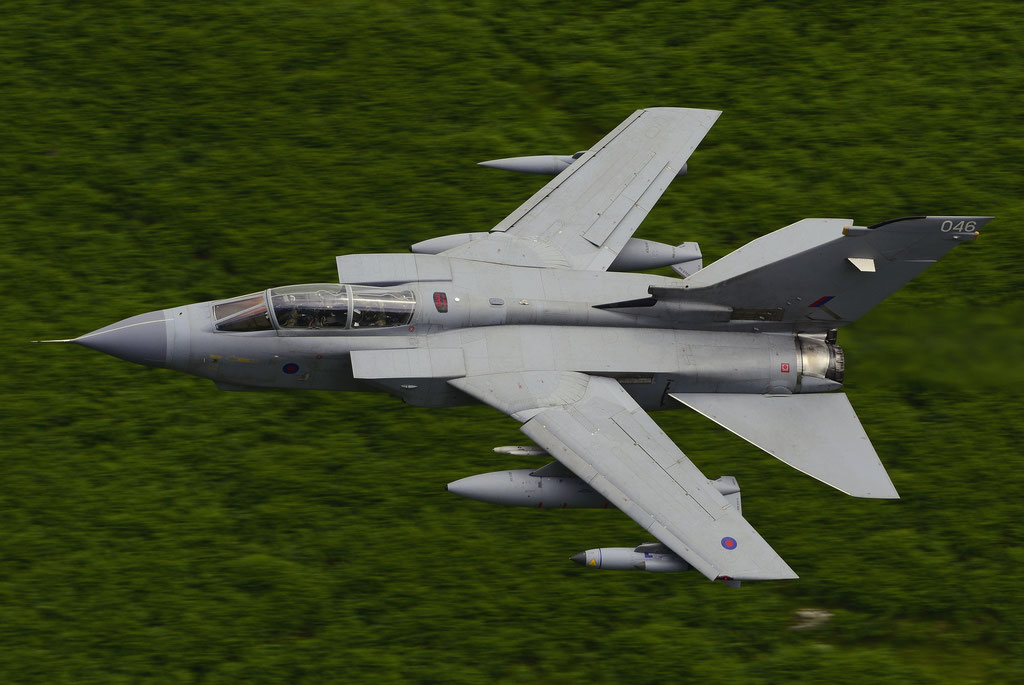
Low flying is an vital skill for military aircrew, and the Royal Air Force, as well as the United States Air Force and other European Forces, uses various areas of the United Kingdom for low level flight training. The United Kingdom is split into 18 low flying areas; the LFA’s being numbered 1-19 (strangley there is no LFA15). The Ministry of Defense website has a map showing the location of the low fly areas. The Mach Loop is located within LFA7, which covers the whole of Wales, except for a small section in the north-east of Powys, which is within LFA9. (credits to https://machloop.co.uk/ http://www.mjaviation.co.uk)
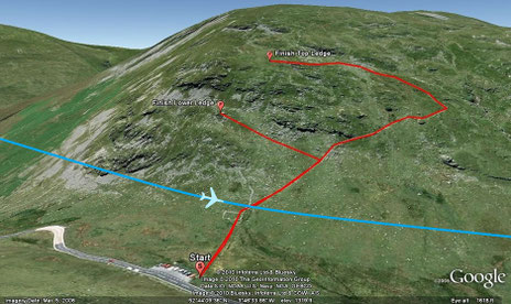
The Bwlch is situated five miles east of Dolgellau on the A470 road to Dinas Mawddwy.
The Bwlch was the first place I used for shooting low level pictures. When looking down the valley from the main viewing location you get a fantastic view of the aircraft, as they snake their way through the twist, and turns of this very narrow valley. The aircraft usually come in from the east and can either turn left towards the Cad pass, straight on for Dolgellau, or turn right and head up towards Bala. (Direction of flow - Right to Left// Hillside faces - North-East =Aircraft pass from East to West)